
 A SCHOLARLY BOOK REPOSITORY
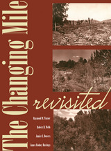
Using nearly two hundred additional triplicate sets of unpublished photographs, The Changing Mile Revisited utilizes repeat photographs selected from almost three hundred stations located in southern Arizona, in the Pinacate region of Mexico, and along the coast of the Gulf of California. Coarse photogrammetric analysis of this enlarged photographic set shows the varied response of the region's major plant species to the forces of change. The images show vegetation across the entire region at sites ranging in elevation from sea level to a mile above sea level. Some sites are truly arid, while others are located above the desert in grassland and woodland. Common names are used for most plants and animals (with Latin equivalents in endnotes) to make the book more accessible to non-technical readers.
The original Changing Mile was based upon a unique set of data that allowed the authors to evaluate the extent and magnitude of vegetation change in a large geographic region. By extending the original landmark study, The Changing Mile Revisited will remain an indispensable reference for all concerned with the fragile desert environment.
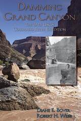
In 1923, America paid close attention, via special radio broadcasts, newspaper headlines, and cover stories in popular magazines, as a government party descended the Colorado to survey Grand Canyon. Fifty years after John Wesley Powell's journey, the canyon still had an aura of mystery and extreme danger. At one point, the party was thought lost in a flood.
Something important besides adventure was going on. Led by Claude Birdseye and including colorful characters such as early river-runner Emery Kolb, popular writer Lewis Freeman, and hydraulic engineer Eugene La Rue, the expedition not only made the first accurate survey of the river gorge but sought to decide the canyon's fate. The primary goal was to determine the best places to dam the Grand. With Boulder Dam not yet built, the USGS, especially La Rue, contested with the Bureau of Reclamation over how best to develop the Colorado River. The survey party played a major role in what was known and thought about Grand Canyon.
The authors weave a narrative from the party's firsthand accounts and frame it with a thorough history of water politics and development and the Colorado River. The recommended dams were not built, but the survey both provided base data that stood the test of time and helped define Grand Canyon in the popular imagination.
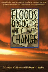
This book shows that floods and droughts don't happen by accident but are the products of patterns of wind, temperature, and precipitation that produce meteorologic extremes. It introduces the mechanics of global weather, puts these processes into the longer-term framework of climate, and then explores the evolution of climatic patterns through time to show that floods and droughts, once considered isolated "acts of God," are often related events driven by the same forces that shape the entire atmosphere.
Michael Collier and Robert Webb offer a fresh, insightful look at what we know about floods, droughts, and climate variability—and their impact on people—in an easy-to-read text, with dramatic photos, that assumes no previous understanding of climate processes. They emphasize natural, long-term mechanisms of climate change, explaining how floods and droughts relate to climate variability over years and decades. They also show the human side of some of the most destructive weather disasters in history.
As Collier and Webb ably demonstrate, "climate" may not be the smooth continuum of meteorologic possibilities we supposed but rather the sum of multiple processes operating both regionally and globally on different time scales. Amid the highly politicized discussion of our changing environment, Floods, Droughts, and Climate Change offers a straightforward scientific account of weather crises that can help students and general readers better understand the causes of climate variability and the consequences for their lives.
The Colorado River and its deeply entrenched canyons create a lengthy barrier to travel in the interior West. Here and there, ancient Indian foot trails descend canyon walls and find access to the river, but one of the few places between California and Nevada where wheeled vehicles can approach it is at the mouth of the Pahreah River, between Glen Canyon and the river's steep drop toward Grand Canyon. Here, from the mid-19th until well into the 20th century, Lee's Ferry was a primary link between Utah and Arizona. Mormons trying to reach potential Indian converts and new lands for colonization to the south first developed the site. John D. Lee and parts of his family, seeking an inconspicuous spot after the Mountain Meadows massacre, first took up residence at what they called Lonely Dell. In subsequent decades, many interesting and important western characters passed through this topographical and historical funnel, from John Wesley Powell to Buffalo Bill. As river exploration and adventure increased, the place became as important to those using the river-surveyors, miners, river runners-as to folks crossing it. In recognition of its importance, Lee's Ferry has been partially restored as a historic site in the national park system.
P. T. Reilly, himself a legend on the river as boatman and chronicler, wrote the detailed and colorful history this place demanded, focusing on stories of the hodgepodge of people it attracted. He died before he finished reworking his massive narrative into book form, but Robert H. Webb, author of Grand Canyon: A Century of Change, completed that job and selected rare historical photos from the Reilly collection at Northern Arizona University to illustrate it. An epilogue by Richard Quartaroli provides a biographical sketch of P. T. Reilly.
In The Mojave Desert, thirty-eight scientists who are all specialists in desert ecology address the threats to the Mojave, as well as the potential for natural recovery and active restoration. The contributing authors discuss the desert from several perspectives: regional threats such as expanding human populations, climate change, atmospheric nitrogen deposition, and invasive plants; the impact of roads in a desert ecosystem; soils and plant communities; shrinking aquifers; and the monitoring and sustainability of this fragile ecosystem. Finally, they discuss the importance of long-term data and the ways scientists and resource managers can interact to enhance understanding of the processes of change in the Mojave Desert and to advance the preservation and restoration of its precious resources.The Mojave Desert offers the fruits of extensive research in a number of disciplines and a sound assessment of the current state and possible future of one of the world's major deserts. As human intrusion and climate change increasingly threaten the Mojave's ecosystem, studies like this are essential in helping scientists, land managers, and the general public understand what is at risk and what can be done to preserve this austere and hauntingly beautiful region.
This volume explores the technical and geographic scope of this important technique, focusing particularly on the intertwined influences of climatic variation and land-use practices in sculpting landscapes. Contributors offer a broad-perspective review of the state-of-the-art of repeat photography, with twenty-three chapters written by researchers around the globe who have made use of repeat photography in their work. Topics addressed include
the history of repeat photography
techniques for creating and analyzing repeat photographs
applications in the geosciences
applications in population ecology
applications in ecosystem change
cultural applications
Repeat Photography demonstrates the wide range of potential applications, examines new techniques for acquiring data from repeat photography, and clearly shows that repeat photography remains a valuable and efficient means of monitoring change in both developed and developing regions. Over one hundred sets of photographs, including thirty-two pages of color photos, serve as examples.
Recent concerns about climate change and its effects on natural landscapes, combined with ongoing concerns about land-use practices, make this state-of-the-art review a timely contribution to the literature.
Authored by an esteemed group of scientists, Requiem for the Santa Cruz thoroughly documents this river—the premier example of historic arroyo cutting during the late nineteenth and early twentieth centuries, when large floodflows cut down through unconsolidated valley fill to form deep channels in the major valleys of the American Southwest. Each chapter provides a unique opportunity to chronicle the arroyo legacy, evaluate its causes, and consider its aftermath. Using more than a collective century of observations and collections, the authors reconstruct the circumstances of the river’s entrenchment and the groundwater mining that ultimately killed the marshlands, a veritable mesquite forest, and a birdwatcher's paradise.
Today, communities everywhere face this conundrum: do we manage ephemeral rivers through urban areas for flood control, or do we attempt to restore them to some previous state of perennial naturalness? Requiem for the Santa Cruz carefully explores the legacies of channel change, groundwater depletion, flood control, and nascent attempts at river restoration to give a long-term perspective on management of rivers in arid lands. Tied together by authors who have committed their life’s work to the study of aridland rivers, this book offers a touching and scientifically grounded requiem for the Santa Cruz and every southwestern river.
READERS
Browse our collection.
PUBLISHERS
See BiblioVault's publisher services.
STUDENT SERVICES
Files for college accessibility offices.
RECENTLY PUBLISHED


UChicago Accessibility Resources
home | accessibility | search | about | contact us
BiblioVault ® 2001 - 2024
The University of Chicago Press